
Kalná nad Hronom — reference environment
SmartGovIOT pilot project
Solutions tested in a real municipal environment
SmartGovIOT is being developed in Kalná nad Hronom in response to practical needs in municipal asset management and operations. The project connects questions that are related in everyday work: where equipment is located, what supporting information is available, what measurements show and who is responsible for the next steps.
Kalná nad Hronom provides a reference environment for data preparation and gradual pilot testing of individual solutions. We work with available information about sites, technology and metering points and examine how to turn it into a usable shared overview.
The platform is in development. Individual areas therefore do not have the same scope or the same level of readiness. This page explains what forms the recorded foundation, what is being tested and what remains planned development.

How to read the status of individual areas
Actually recorded or in use means that we can substantiate the scope described through documents, data or operational verification. We distinguish between the existence of documentation, prepared records and a technical connection that is actually working.
Under pilot testing indicates a specific scope in which we are testing functionality, data quality and the practical way of working. A pilot of one activity does not mean the automatic deployment of the entire related area.
Planned direction represents capabilities in preparation that we do not yet describe as a working deployment in the reference environment.
This page describes the reference environment, not a general catalogue of the platform's capabilities. A feature may be supported in a particular solution without also being connected at a specific site in Kalná nad Hronom.
Areas being tested
Municipal asset and technical equipment management
Status: Under pilot testing
The working foundation consists of records of municipal locations and sites, available information about their technical equipment and links to metering points. When preparing asset registers, we connect this material with documentation and mark data that needs to be added or checked.
Within a selected scope, we are testing how to identify equipment unambiguously, assign it to the correct space and retain related records. Records of inspections, faults, completed work and responsibility can then build on this foundation.
A working register is not yet a complete, physically verified asset register. Historical data is not regarded as confirmation of the equipment's current condition.
We are testing: equipment identification and location, assignment of documentation, the distinction between confirmed and unverified data, and how operational activities follow on from one another.
Energy and consumption
Status: Recorded data / under pilot testing
A working register of electricity, gas and water metering points has been prepared, linked to municipal sites and available historical meter readings. This material is used to test consistent records, consumption calculations and data quality checks.
An important part is distinguishing what a value represents, which source it comes from and which period it applies to. When preparing overviews, we therefore retain missing-data indicators, uncertainties and circumstances that may affect comparison.
Working with historical meter readings does not mean automated access to new interval data. Connections to authorised data channels, including OKTE/EDC, have their own conditions and verification requirements.
We are testing: assignment of metering points, the quality of supporting information, comparison of periods and preparation of usable energy overviews.
IoT and LoRaWAN infrastructure
Status: Partly operational
The basic LoRaWAN communication layer receives data from compatible remote devices. It provides a starting point for gradually connecting measurements according to the specific purpose and site conditions.
Expansion includes assessing sensor suitability, communication at the installation point and the usability of received data. What matters is not only the delivered value, but also its time, meaning and recognition of a situation in which new data is not arriving.
The existence of the communication layer does not confirm coverage throughout the municipality or deployment of every type of environmental sensor. We describe a particular measurement location as operational only according to its actual connection and verification.
We are testing: transmission reliability, data availability and the conditions for gradually connecting supported sensors.
Public lighting
Status: Documentation foundation / field verification
A documentation foundation has been compiled for public lighting points, distribution boards and available technical relationships. It provides a starting point for operational records and for selecting the data that needs confirmation in the field.
The aim is to preserve the identity of individual components, add current information and create links to faults and service interventions. Verification focuses on a selected scope, rather than pretending that the entire network has been fully mapped in one step.
Historical documentation may not reflect the current condition. Equally, records of lighting points do not automatically mean individual metering or remote control of those points.
We are testing: whether identifiers are up to date, the location of selected components, available technical data and the method of recording faults and repairs.
Security and operational events
Status: Documented technologies / testing in preparation
Available information describes selected camera and security technologies and their links to locations. We are preparing this documentation foundation for further assessment of technical-status records and permitted operational events.
A device's presence in a register does not yet mean a working integration. Before connection, its identity, available data, permitted scope of access and the meaning of individual reports need to be verified.
In this area, SmartGovIOT is not to transmit, display or store camera footage, images or data obtained through image analysis. Camera and security systems remain separate. Activating, deactivating or bypassing security components is not part of the basic pilot.
We are preparing to test: the availability of technical states, assignment of an event to a device and the process by which the responsible staff member checks it.
Transport and technical infrastructure
Status: Planned direction
We are preparing a way to record local roads, traffic infrastructure components and related technical assets in connection with their location, documentation and maintenance.
Before defining a specific pilot, the available registers, ownership and management responsibilities need to be assessed. Component identification and the quality of geographical data also need verification so that any map overview does not imply a precision unsupported by the source information.
We do not yet present this area as a completed digital road asset register or a finished deployment.
We plan: preparation of a suitable scope of records, links to locations and a workflow for inspections, reporting deficiencies and recording repairs.
What pilot testing should demonstrate
The data is usable for a specific question
For each area, we need to know what information exists, where it comes from and what conclusions can be drawn from it. We therefore verify not only its display, but also correct assignment, currency and meaning.
If data is missing or disputed, that should be visible. Incomplete source material should not become seemingly confirmed information merely because it has been transferred into a system.
Staff can proceed to the next step
A working overview should help staff find a site, understand a problem and establish what needs to be done. For a task, responsibility, available information and the way the result is recorded are essential.
We also check continuity of work: whether findings are retained when a task is handed over and whether closing it conceals the need for further action.
The records remain usable after the initial data entry
Preparing data is only the beginning. It is necessary to define how equipment replacement, a new document, a completed inspection or a change of responsible person will be recorded.
Measurement also requires provision for equipment checks, outages and maintenance. The assessment therefore includes the demands of long-term management, not just a successful first connection.
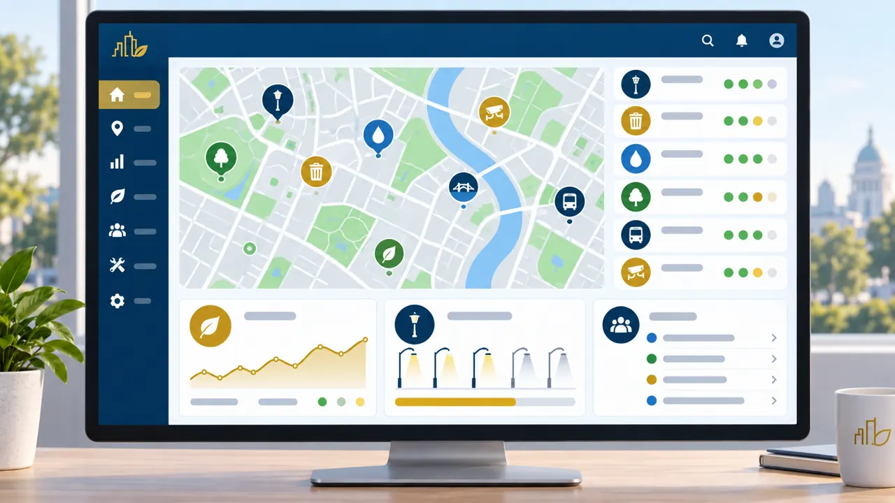
We connect individual areas into a shared operational view
A building may have equipment records, documentation, metering points and an unresolved fault. Each record describes a different part of operations, but they may be needed together for a decision or intervention.
We are developing SmartGovIOT so that the relationships between this information are preserved. A measurement belongs to the relevant location, a service document to a particular device, and a completed activity to the task it addressed.
The shared view is intended to help management understand significant events and staff reach the information they need. It results from gradually connecting areas; it is not, on its own, evidence that every feature already works at every site.
What other municipalities can learn from the reference environment
It is primarily the approach that should be transferable: select a specific need, verify the available information, define a proportionate scope and evaluate the result.
Every municipality has a different organisation of work, technical equipment and quality of records. A solution therefore cannot be copied from one environment to another without assessment.
Experience from the reference environment is intended to help define the necessary steps more clearly and identify questions that need to be resolved in advance. Another municipality may start with a different area or remain at a smaller scope if that meets its needs.
We state only what we can substantiate
We distinguish prepared information, technical verification and a solution actually in use.
Counts of sites or devices can describe different things: entries in a source document, records in a working register or physically verified components. Publishing them without explanation could give an incorrect impression of the project's scope.
We therefore publish precise figures, results and reference statements only after verification, clarification of their meaning and approval for public use. Equally, the mere presence of technology in a municipality is not proof of its integration into SmartGovIOT.
Kalná nad Hronom is the project's reference environment. This designation does not, by itself, mean deployment of the entire platform, an official partnership or a formal commercial reference from the municipality.
The public presentation describes the way of working and the scope of testing. It does not publish internal technical asset registers, sensitive operational data or details not intended for public use.
Would you like to address a similar area in your municipality?
Tell us what you need to improve, which sites or operational areas are involved and what information you have available. You do not need an extensive technical specification or to start with the whole municipality.
We first analyse the request and propose suitable next steps. These may involve organising records, verifying a particular measurement or piloting a workflow with a clearly agreed objective.
Alternative contact: info@smartgov.sk